SALARS OF THE ANDES
There are more than 50 major dry to seasonally wet salt lakes, or salars, in the Andes that begin to the south of Lake Titicaca where the rainfall significantly drops off. These are nested in large depressions within the internally drained Altiplano and within smaller inter-volcanic depressions. Many of the salars make for a network that has been combined by tourists into what has been termed the Gringo Trail. This well-trodden route goes from landing in Lima Peru, a flight to Cusco, the obligatory visit of Machu Picchu, travel south to Lake Titicaca and entering Bolivia at La Paz. The trip goes south to pay homage at Cerro Rico in Potosi, and then meanders through the world’s largest salt flat at Salar de Uyuni where silly forced perspective photography fills in the time. From the dusty frigid desperate town of Uyuni the route goes into the wilderness, coming through Laguna Verde and the stop over at the hot Spring Chilvari, and afterwards descends into Chile and the desert town of San Pedro de Atacama in the large Salar de Atacama. Many will catch a flight out from the nearby city of Calama to end the journey, while others will push onwards, driving south to pass the small but extremely scenic Salar de Aguas Calientes, cross the border at Paso Sico into Argentina, possibly taking a quick detour south to visit this country’s second largest Salar de Arizaro, and then connect through the small little-developed San Antonio de Cobres village and then finally ending at the city of Salta.


Salar de Uyuni is equant, measuring 108 by 110 km in diameter, and makes an immense white pan at 3,663 meters elevation. The town of Uyuni struggles at the salt lake’s southern border and mainly caters to the passing tourists, although in the past it was a center of commerce in support of the Pulacayo silver mine located off to the east. Those visiting Salar de Uyuni typically enter from the east side the playa coming out of Uyuni, stop by the salt hotel, and then follow the straight tracks out to the rocky hilltop in the center of the depression, a hill made of basalt flows and covered in tall cactus, a place called Isla de Incahuasi. The barren hill provides for contrast against the otherwise bland sea of white, and gives one a bit of perspective on the expanse by climbing footpaths uphill some 50 meters for the view. Apart from photographic exercises, a bit of production of salt for domestic consumption, the lake has large poor quality lithium resource that Bolivian politicians cling to as being a potential economic saviour.
The largest salt lake in Argentina is called Salinas Grandes and it is located 57 km north of San Antonio de Cobres. It makes a banana shape that is elongate 46 km in at east-west direction. The much longer narrow valley of Salar de Antofalla, lined by discontinuous salt flats, runs for 136 km. Argentina also has perhaps the farthest south major salt flat in the lowlands east of the city of San Juan at a place called Las Salinas (latitude 32 degrees south).
The inter-volcanic depressions marked by smaller salt flats and lakes, dotting the Central Volcanic Zone that straddles the border between Chile and Argentina, makes for some of the more scenic extreme landscapes. These include the salars of Carcote, Ascotan, Pastos Grandes, Capina, Chalviri, Incahuasi, Rincón, Pocitos, Gorbea, Las Parinas, Aguilar, Infieles, Pedernales, Maricunga, San Francisco, and Laguna Blanca. Contrasting white salt pans with the backdrop of high rugged barren reddish-brown to gray, and to tan volcanic summits enclosing the basins, which have variable colored lakes, provide the photographer’s subject media and the artist’s inspiration. Many salars have limited marshes along one side that are frequented by flamencos. There are plenty of opportunities to experience these highland salars off of the Gringo Trail, to camp, and to be alone in complete solitude. Some of these salars come with hot springs, such as at Polloquere, Termas de Volcan Isluga, Chalviri, Alcancha, and Termas de Laguna Verde, attesting to the still active geothermal nature of the surrounding volcanoes.


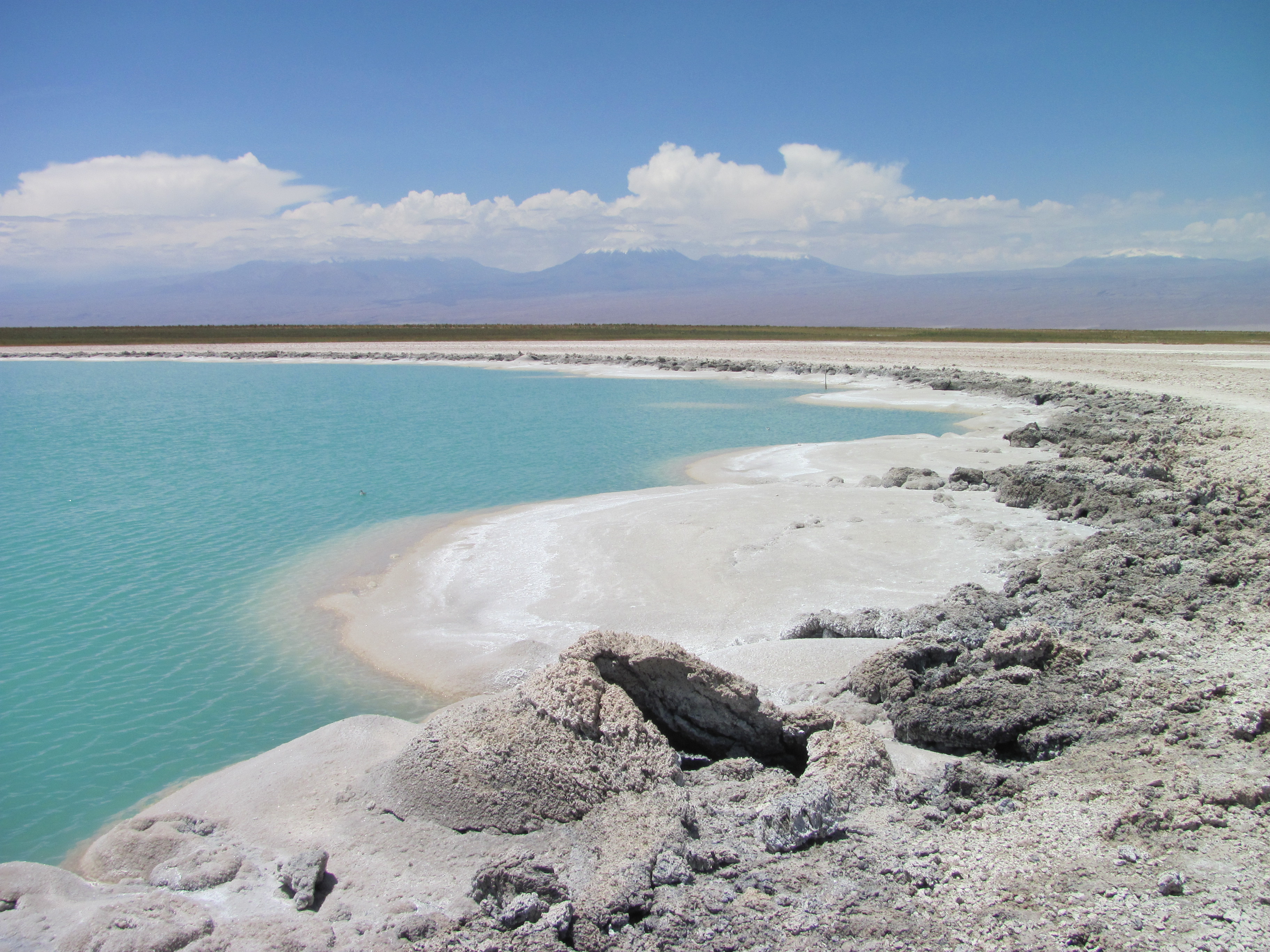
In addition to simple table salt, mineral name of halite (NaCl), other evaporate minerals include gypsum (CaSO4+2H2O), sylvite (KCl), sodium nitrite (a major fertilizer), and are usually enriched in iodine. Most of the salt flats, depending on the timing of the last rains and time for desiccation, will be patterned with large polygonal shrinkage cracks. Around the borders of small saline lakes some of the halite can form coarse crystals, such as those found around the small Laguna Cejar in the Salar de Atacama. In rare cases, exotic salt bubbles have formed in the Salar of Maricunga. Additionally, around Salar de Pedernales one can find low white sand dunes formed of gypsum. Many of the lowland salt flats and caliche pans along the central valley of Chile in the Atacama Desert have a long history of extraction evaporite minerals for fertilizers. This desert is dotted with numerous old closed ghost towns that were once the production centers called oficinas. Modern plants, mainly operated by Soquimich (SQM), continue today making Chile the largest producer of iodine. These lowland salt fields have an abundance of nitrites and iodine salts, the origin for which is still contested today, with some suggesting that the action of lightning is required in their formation or evaporative pumping for deep basinal brines.
The salars of the Andes have some that are highly frequented, others are national reserves, some are exploited for minerals, and many are just in remote places and rarely visited.
Do connect with us:
ResearchGate: James M. Wise
Author´s page: James M. Wise
Photography page: JamesM.Wise.com
Author´s page: Yanira K. Wise
South America seems to refuse to show its inexhaustible creative force.


