On the preservation and nature of paleo-surfaces and their associated deposits along the Pacific Flank of the Peruvian Andes
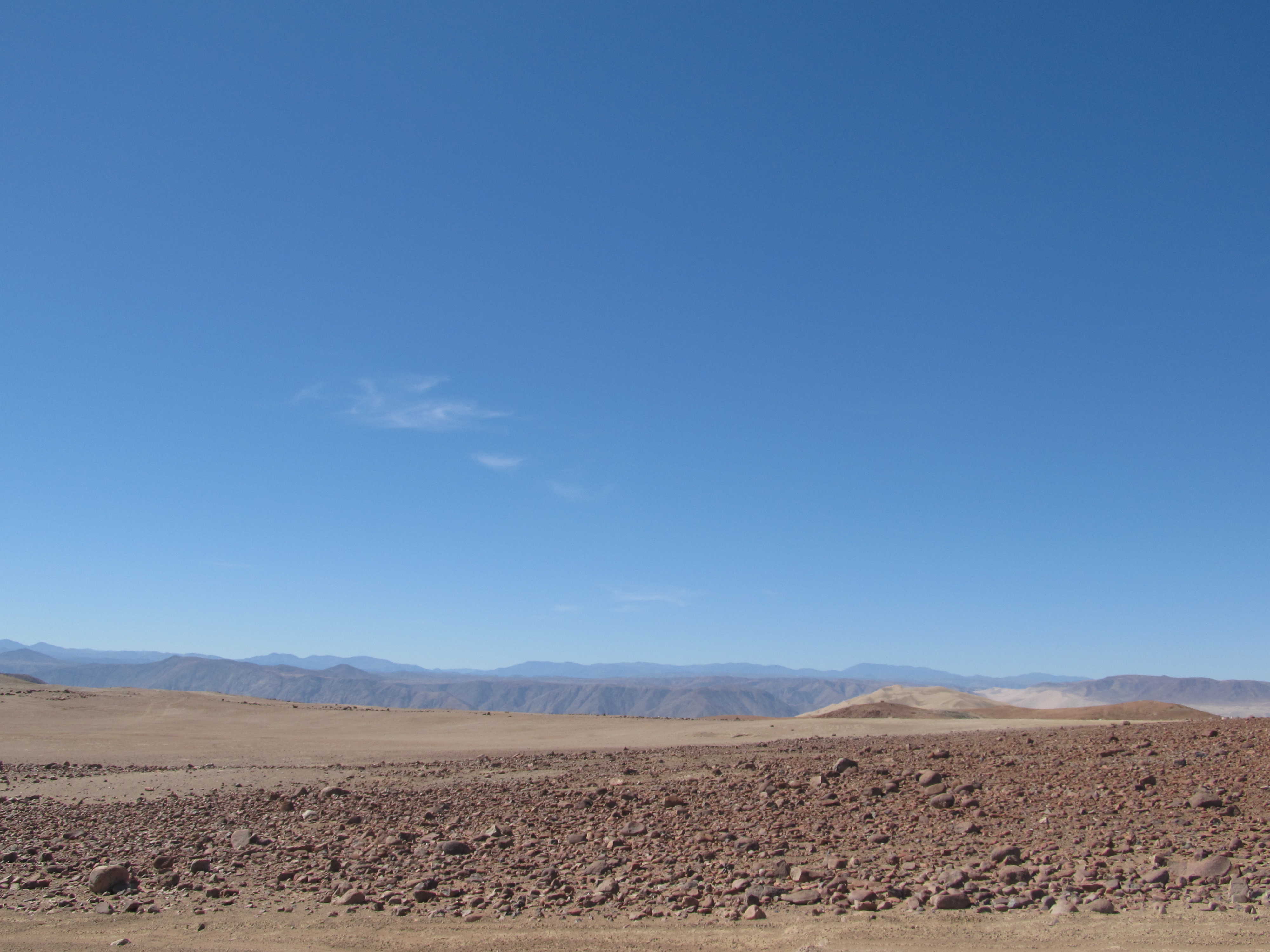
The westward-tilted erosion surfaces along the Pacific slope have a significantly greater amount of preserved volcanic deposits to the south of the insertion point of the subducting Nazca ridge than to the north. The near ubiquitous erosion surfaces of the Andean Pacific flank are a long-lived geomorphic feature responding to ongoing, yet episodic, uplift and compression in the overriding plate in the east-direct subduction zone. The above article header image is from Pampa de Cobre, showing extensive planar horizons on the broad interfluves cut by deep canyons. These regional erosion surfaces, or in some works termed pediments, has been the subject of several studies (e.g., Tosdal et al., 1984), and still requires additional work to fully understand them. In central Peru, the Pacific surfaces have been further modified by the passage, and still continuing, oblique subduction of the Nazca ocean ridge.
Westward-tilting of the Pacific slope preserved on the interfluves
From just north of Lima to northern Chile, the Pacific slope of the Andes (McLaughlin, 1924), also called the Pacific lowlands (Sébrier et al., 1988) and the Pacific pedimont (Tosdal et al., 1984), is characterized by several major erosional surfaces (Dollfus, 1965; Mortimer, 1973). These surfaces dip gently to the southwest, and the oldest ones bevel the Coastal batholith, Mesozoic eugeoclinal rocks, and the Arequipa Massif. The erosion surfaces in central and southern Peru (Fig. 1) formed at different times, and record a complex history of uplift, rotation, incision, and partial burial of paleotopgraphy that has extended more or less continuously from at least the middle Eocene time to the present (Dollfus, 1973; Myers, 1976; Noble et al., 1978; 1979a; 1979b; Tosdal et al., 1984; Laharie, 1985; Sébrier et al., 1988; Worner et al., 2002). In some areas, isotopic dates on volcanic rocks provide minimum ages for the surfaces.

Figure 1. Diagram illustrating the distribution of Tertiary volcanic rocks overlying westward-tilted erosion surfaces with respect to the continental divide and the general elevation of the Andes that are above 3,000 m. The volcanic deposits are more common south of the Nazca ridge than to the north along its trailing edge. The Nazca Group volcanic rocks are situated in the higher elevations and this greater elevation may be related to plate uplift above the crest of the subducting Nazca ridge. Both dated locations and areas of uplifted shorelines are indicated. Pacific flank covering ash-flow sheets are hardly preserved to the north of Lima.
Near Lima a surface that exposed the Coastal batholith is overlain by ash-flow tuff dated at 41.3±0.5 Ma (Noble et al., 1978b; 1979a). This surface probably developed after the >45 Ma Incaic deformation that affected the South American margin from Ecuador to central Chile (Noble et al., 1979a; 1980; Farrar et al., 1988; Sandeman et al., 1995; Benavides-Cáceres, 1999). The Eocene volcanic rocks were partially eroded, and in places an ash-flow unit dated at about 26 Ma overlies the surface (McKee and Noble, 1982).
To the south Lima, erosion surfaces are overlain by ash-flow sheets that have been assigned to the Pocoto Formation (Salazar and Landa, 1993). We sampled and dated this unit, producing new 40Ar/39Ar isochron date on a biotite separate of 32.75±0.38 Ma, sampled at the latitude of Quilmaná (Figure 2). Near the pueblo of Quilmaná, the ash-flow sheet was deposited on a surface of very gentle paleo-topography that has an average southwestward dip of about 5 degrees and extends to an elevation of about 2,600 m. What appears to be a post-Incaic unconformity is exposed a few kilometers to the east of Quilmaná at an elevation of about 3100 m. To the southwest of Quilmaná, silicic volcanic material of similar ages was deposited in the Pisco forearc basin (Macharé et al., 1988; DeVries, 1998).
East of Ica, an irregular westward-tilted erosion surface rises to an elevation of about 4,000 m, maintaining a dip of about 4 degrees to the southwest. It lies beneath a planar ash flow sheet, correlated to the Pocoto Formation, but this tuff is probably of different age. This area has a local and discontinuous ~300 m-thick section of andesitic tuff and breccia preserving a second, older, erosion surface accompanied with gentle local paleo-topography.
Northeast of Nazca, the Nazca tuff, a sequence of ash-flow sheets dated at its base at about 21-22 Ma (Noble et al., 1979b), overlies a thick section of conglomerate that in turn overlies an erosion surface that dips 3.2 degrees to the southwest (Figure 2). It crops out from about 1,000 to 4,200 m in elevation. Recent uplift of this region by the Nazca ridge probably raised this surface more than 1,000 m with respect to regions to the south. Northwest on the trailing side of the obliquely subducted ridge a much lower percentage of volcanic rocks are preserved overlying the westward-tilted surfaces (Fig. 1), reflecting transitory strong uplift and more intense erosion related to the passage of the ridge.

Figure 2. Diagrammatic sketches of major west-tilted unconformties and bounding formations along different latitudes of the Pacific slope (drawing is not to scale). U1= post-Incaic II unconformity ~45 Ma, U2= Oligocene unconformity, U3= post-Aymara unconformity ~26 Ma, U4 = ~22 Ma unconformity, and U5 = composite Quechua 1 and 2 unconformity developed over 17 to 5 Ma, and includes both the historic Puna and initial Canyon stage erosion.
Even younger late Cenozoic composite surfaces in southern Peru near Moquegua (Figure 3) illustrate continued planation and deposition of the westward-tilted domain, affecting rocks of late Miocene to Pliocene age (Tosdal et al., 1984). The oldest of the bedrock-cutting surfaces, called the Altos de Camilaca surface, is overlain by sandstone and conglomerate beds of the lower Moquegua Formation. An Eocene age for the surface is provisionally calculated by a previously unreported K-Ar age of 47.0±1.4 Ma on plagioclase from a bed of tuff within the Cenozoic clastic section exposed several kilometers north of the Rio Majes (sample location 16°S, 72.41°W). The true age of the tuff may, however, be younger because of possible incorporation of detrital feldspar in the tuff. Within the Moquegua Formation is a thin horizon of possible marine sediments that is overlain by tuff dated at about 25 Ma (Tosdal et al., 1981; Noble et al., 1985), however, this surface may be older than the minimum upper limit of 25 Ma. In the Moquegua area the surfaces rise to an elevation of about 2,000 m. Tosdal et al. (1984) argued that this surface developed near sea level, and consequently the tilting of the Pacific slope must postdate the latest Oligocene. The basal contacts of the lower Moquegua Formation (U1-2?), the upper Moquegua Formation (U3), and the 17.8 to 21.6 Ma Huaylillas Formation (U4) all locally overlie the Mesozoic basement rock (Fig. 2).

Figure 3. Picture looking at the canyon wall near the city of Moquegua showing the near flat lying section of gravels. These deposits dip very gently towards the west. They are locally interbedded with thin ash horizons.
There does not seem to be any systematic north-south variation in the slope angles along the Pacific flank of the Andes. Pedimentation and incision along the Pacific slope records the uplift of the Andes by rotation between the Cordillera Occidental rising to the east and offshore subsidence in the forearc to the west. The amount of tilting is difficult to determine from the above-discussed erosion surfaces because the pedimentation process is poorly understood and therefore little is known on the original formation angle of the surfaces. As shown in Figure 3, the multiple unconformities underlying the ash-flow sheets and alluvial aggraded units are discontinuous along the Pacific slope. Younger unconformities probably represent reactivation and modification of the older erosion surfaces. However, significant incisement of the Pacific slope did not begin until the late Miocene Canyon-stage erosion. The various Pacific slope erosion surfaces may relate to the composite Puna surface to the east as shown in Figure 4. In this model most of the deposits that partially mantle the Pacific slope represent a clastic apron of material shed from an incrementally uplifted highland to the east.

Figure 4. Simplified model of multiple Pacific slope erosion surfaces related to incremental uplift of the Cordillera Occidental, culminating in the composite Puna erosion surface. Dip angles exaggerated. Along strike previous aggraded surfaces may be reactivated, not preserving older unconformities. Area of planation is also accompanied by episodic volcanic complex construction.
Mechanism to cause Pacific Flank westward-tilting of the Andes
Ongoing, probably episodic uplift, combined with tectonic erosion in the forearc region, produced gentle southwestward-tilting of the rigid portion of the Pacific slope underlain by the Coastal batholith. The zone east of the Coastal batholith formed an extensive, polycyclic mainly mid-Miocene, erosion surface, known as the Puna erosion surface. This was locally being incised by eastward-flowing drainages before the late Miocene. Pacific-flank rivers maintained graded profiles, representing equilibrium between uplift and erosion, and westward-dipping erosion surfaces and overlying volcanic rocks of Eocene to early Miocene age are in places preserved along the interfluves. The High Plateau Province and the Cordillera Oriental to the east did not behave as rigid, passive blocks but instead were deformed by repeated pulses of compression and extension accompanied with a strike-slip component. The Amazon flank is seismically active compressive deformation in the Cordillera Oriental and the foreland fold and thrust belt that accounts for a significant portions of the Andean horizontal shortening.
Forearc tectonic erosion produced the western domain of subsidence and extension in the forearc wedge (von Huene et al., 1985; von Huene and Lallemand, 1990), and enhanced the westward-tilting of the Pacific slope. Large-scale block rotation in the western part of the orogen produced the westward-tilted surfaces of the Pacific slope. Westward-tilted surfaces in Chile were suggested by Isacks et al. (1998) and Worner et al. (2002) to be part of a monocline related to ongoing compression. Their model does not consider long-term evolution of the surfaces nor the exhumation patterns to the east. A monocline would result in extensional faults along the outer arc of the fold located in the highland and contraction features offshore, opposite of the observed style of faulting in Peru. The western flank of the Peruvian Andes is sandwiched between areas of subsidence and more intense uplift and therefore must accommodate the differences.
— James M. Wise. May, 2019
References
Benavides-Cáceres, V., 1999, Orogenic evolution of the Peruvian Andes: The Andean cycle, in Skinner, B.J., ed., Geology and mineral deposits of the central Andes: Soc. Econ. Geol. Spec. Publ. 7, 61-107.
DeVries, T.J., 1998, Oligocene deposition and Cenozoic sequence boundaries in the Pisco Basin (Peru): Journal of South American Earth Sciences, v. 11, p. 217-231.
Dollfus, O., 1973, La Cordilleré des Andes: Présentation des problemes géomorphologogiques: Revue Géogaphie Phys. Géol. Dynamique, XV, fasc. 1-2, 157-176.
Dollfus, O., 1965, Les Andes Centrales du Pérou et leurs piémonts (entre Lima et le Péréné): Etude géomorphologique, Trav. Inst. Fr. Et. Andines, T.X., 404 p.
Farrar, E., A.H. Clark, D.J. Kontak, and D.A. Archibald, 1988, Zongo-San Gaban zone: Eocene foreland boundary of the central Andean orogen, northwest Bolivia and southeastern Peru: Geology, 16, 55-58.
Isacks, B.L., Yu, J.S., Alsdorf, D.E., and Frey, K.E., 1998, Neogene deformation of the Western Flank and Forearc of the Central Andes: EOS, trans. ab., 79, F365.
Laharie, R., 1985, Les aplanissements du Sud de Pérou; Premiere Partie: Surfaces, Pédiments, Glacis: Instituto Francés de Estudios Andinos, 14, no. 1-2, 19-47.
Macharé, J., DeVries, T., Barron, J., and Fourtanier, E., 1988, Oligo-Miocene transgression along the Pacific margin of South America: new paleontological and geological evidence from the Pisco basin (Peru): Géodynamique, 3, 25-37.
McKee, E.H., and Noble, D.C., 1982, Miocene volcanism and deformation in the western Cordillera and high plateaus of south-central Peru: Geol. Soc. Am. Bull., 93, 657-662.
McLaughlin, D.H., 1924, Geology and physiography of the Peruvian cordillera, Departments of Junin and Lima: Geol. Soc. Am. Bull., 35, 591-632.
Myers, J.S., 1976, Erosion surfaces and ignimbrite eruption, measures of Andean uplift in northern Peru: Geol. Jour., 11, 29-44.
Noble, D.C., Sébrier, M., Mégard, F., and McKee, E.H., 1985, Demonstration of two pulses of Paleogene deformation in the Andes of Peru: Earth and Planetary Sci. Lett., 73, 345-349.
Noble, D.C., McKee, F.H., and Mégard, F., 1979a, Early Tertiary “Incaic” tectonism, uplift, and volcanic activity, Andes of central Peru: Geol. Soc. Am. Bull., 90, 903–907.
Noble, D.C., Farrar, E., and Cobbing, E.J., 1979b, The Nazca Group of south-central Peru: Age, source, and regional volcanic and tectonic significance: Earth and Planet. Sci. Lett., 45, 80-86.
Noble, D.C., McKee, E.H., and Mégard, F., 1978b, Eocene uplift and unroofing of the coastal batholith near Lima, central Peru: J. Geology, 86, 403-405, 1978b.
Sandeman, H.A., Clark, A.H., and Farrar, E., 1995, An integrated tectono-magmatic model for the evolution of the southern Peruvian Andes (13°-20°S) since 55 Ma: International Geology Review, v. 37, p. 1039-1073.
Tosdal, R.M., Clark, A.H., and Farrar, E., 1984, Cenozoic polyphase landscape and tectonic evolution of the Cordillera Occidental, southernmost Peru: Geol. Soc. Am. Bull., 95, 1318-1332.
Tosdal, R.M., Farrar, E., and Clark, A.H., 1981, K-Ar geochronology of the late Cenozoic volcanic rocks of the Cordillera Occidental, southernmost Peru: J. Volc. Geothermal Res., 10, 157-173.
von Huene, R., and Lallemand, S., 1990, Tectonic erosion along the Japan and Peru convergent margins: Geological Society of America Bulletin, v. 102, p. 704-720.
von Huene, R., Kulm, L.D., and Miller, J., 1985, Structure of the frontal part of the Andean convergent margin: Journal of Geophysical Research, v. 90, p. 5429-5442.
Wörner, G., Uhlig, D., Kohler, I., and Seyfried, H., 2002, Evolution of the Western Andean Escarpment at 18 S (N. Chile) during the last 25 Ma: uplift, erosion and collapse through time: Tectonophysics, v. 345, p. 183-198.
Do connect with us:
ResearchGate: James M. Wise
Author´s page: James M. Wise
Photography page: JamesM.Wise.com
Author´s page: Yanira K. Wise
South America seems to refuse to show its inexhaustible creative force.


