IT IS NOT SCIENCE WITHOUT REPRODUCIBLE LOCATION
Many data types are made in South American geological studies, and other geographical areas, using expensive cutting edge laboratory methods, which then are published in peer-reviewed scientific journals. Whether describing chemical whole rock analyses, oxygen isotopes, microprobe analyses of elemental distributions in single minerals, or radiogenic isotope age determinations one critical aspect of data reporting is all too commonly being glanced over, and that is accurate reporting of the sample location.
One of the basic requirements on conducting scientific inquire is that the results of an experiment are reproducible.
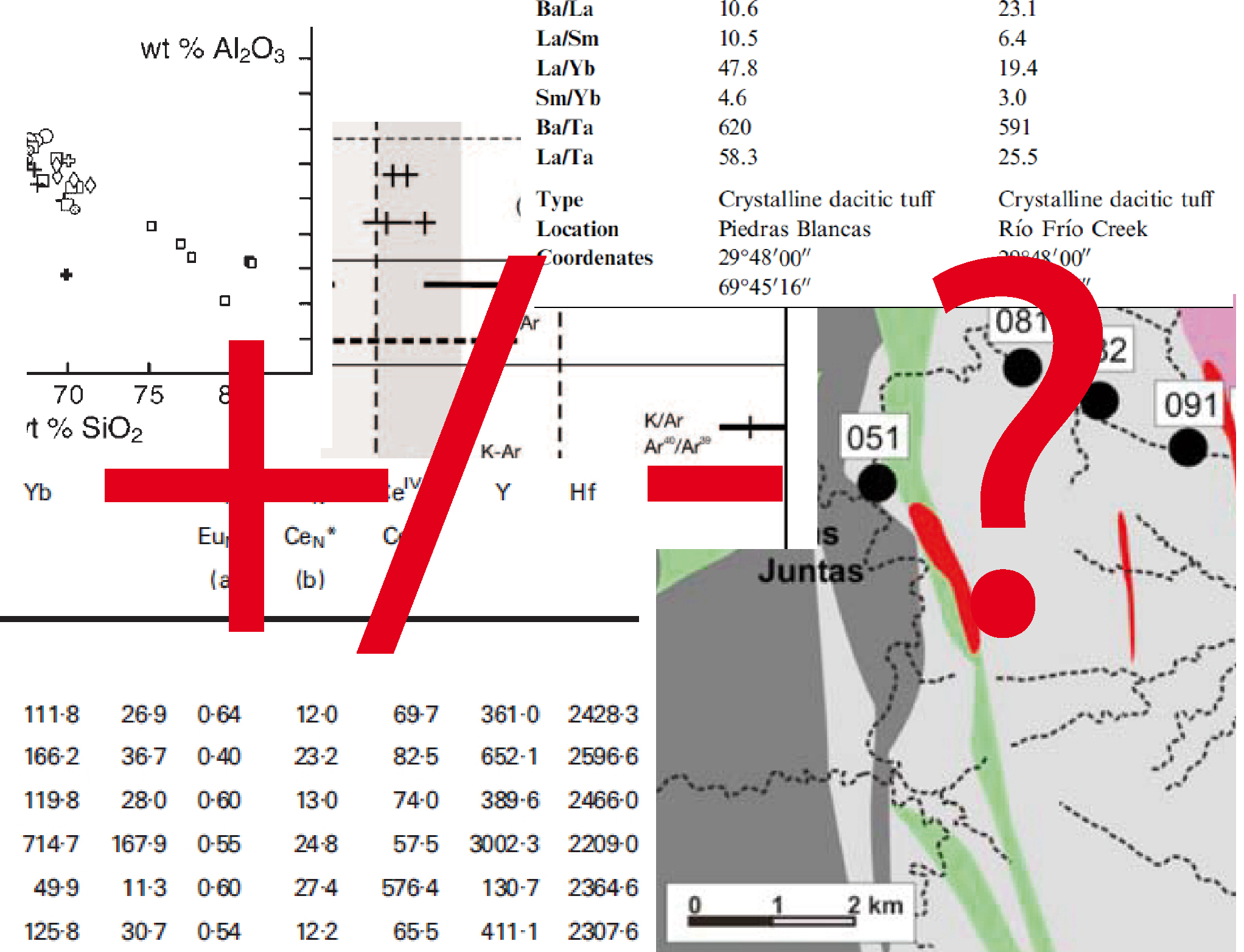
Unfortunately the reporting of sample locations in the geological literature has less rigorous standards than those used in describing sample analysis methods. Perhaps this detail is considered too mundane to occupy the printed page? It is rather shocking the number of studies in journals in which the review panel did not require the authors to actually give sample coordinates. In some cases a study is presented with no locations whatsoever or others provide only a cartoon location map that plots the points. In many such figures the diameter of the sample points corresponds to 300 to 500 meter on the ground. Drafting errors on such diagrams often negate the ability for others to sample the same material and rerun the analysis for verification. This is largely due to graphic programs being used that do not work within a real coordinate framework and from gross simplification during scale reduction to make a page-size figure. Presenting only sample locations in a figure is additionally rather inconsiderate to the reader, requiring others to spend time recreating the locations, which by the way each reader will do somewhat differently, adding additional errors and confusion about the results.
Ideally the sample coordinates for any rock analysis should be listed together with the data, and the map projection used should be specifically stated. For space considerations, many data tables divorce the coordinates from the results by using separate tables, which then later have to be correlated by the reader. Some list the full data in Excel files or text documents provided in an online data archive or data repositories; this covers the minority of publications and finding said data archives may not always be possible or the service may not be maintained over the decades.
Sample error. Most studies give the laboratory error on the result, which is particular absurd when not reporting any sample location, or giving sample locations in latitude/longitude by even minutes that induce rounding errors which translate into 1.8 kilometer shifts in from the actual sample location. Why are people still reporting in the awkward archaic degrees-minutes-seconds format when decimal degrees or UTM reporting is more functional? A two sigma error reported on a U-Pb zircon date from a sample that is miss-located by 8 km has considerable more error than the analytical error if one were attempt to reproduce the result. Lengthy technical descriptions of machine calibrations, standards, instrument errors, and decay factors are all rather meaningless without the field descriptions of the sample and a good location. Survey locations come with positional errors, yet in geology when was the last time you saw somebody report the error on a listed coordinate position?
How deep is this issue on poor reporting practices in the geological literature? Without any hard statistics to present, but after two decades of compiling databases, I would qualitatively estimate about one third of the published studies have presented “information” that cannot be reasonably or reliably spatially reproduced. In addition to clear reporting of sample coordinates the sample context should be described. Journals should require that the authors detail what the sample site consists of in the field, such as outcrop or road cut, the number of meters above the base of a bed, or other key information that would permit somebody to visit the location and find the same geological material that was analyzed.
Analytical results cannot be considered a scientific contribution without paying attention to the basic description of sample location.
Do connect with us:
ResearchGate: James M. Wise
Author´s page: James M. Wise
Photography page: JamesM.Wise.com
Twitter: JamesM_Wise
Facebook: Yanira K. Wise
Author´s page: Yanira K. Wise
Instagram: yanirak.wise
Twitter: @YK_Wise
Facebook for South America to the World
South America seems to refuse to show its inexhaustible creative force.


